Current conditions:
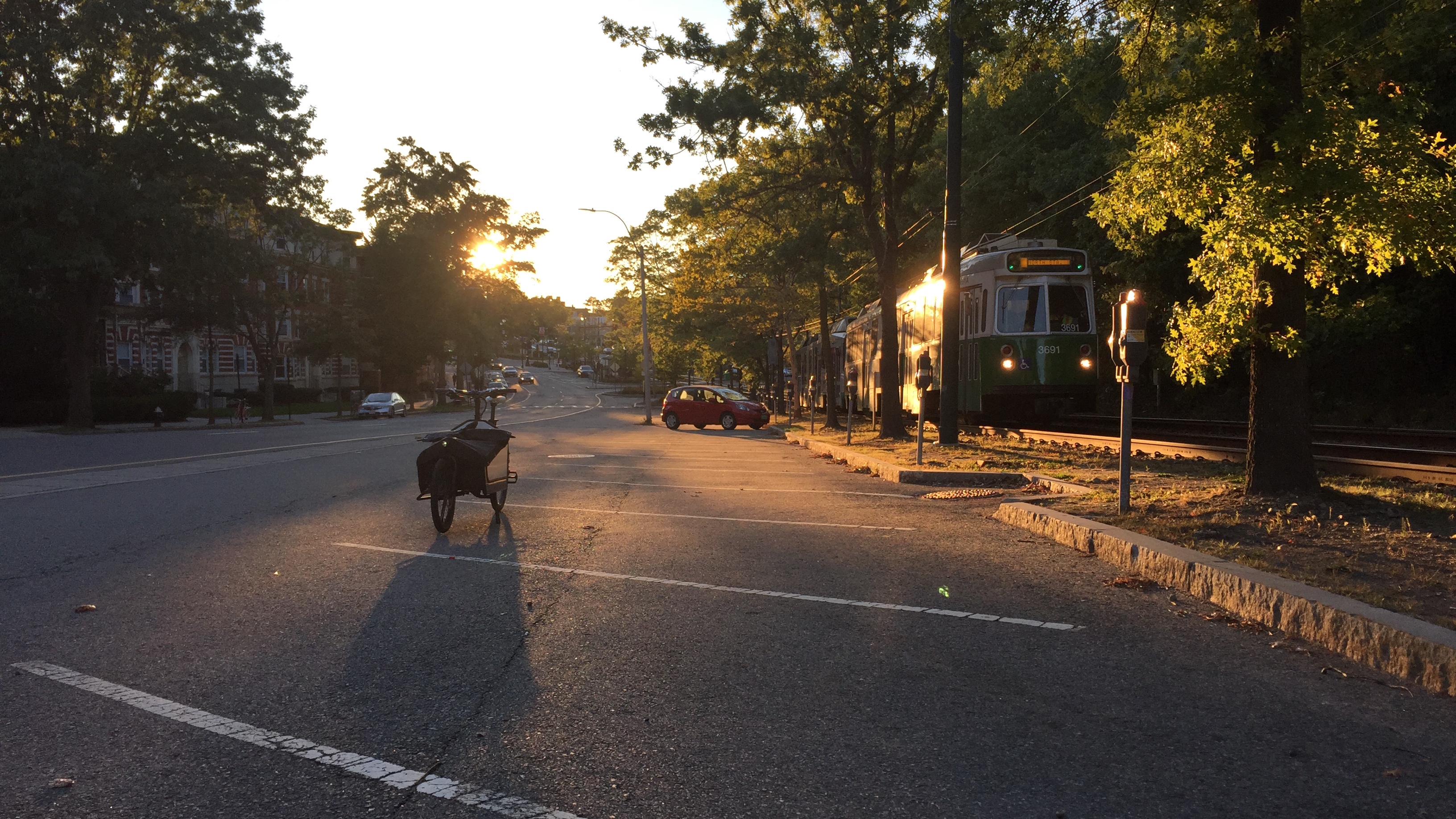
Fairbanks St. / Lancaster Ter. - Summit Path
(5:56 PM, Sun., Oct. 1, 2017)
Restoring the bridle path on Beacon St. in Brookline---
It seems that there is an opportunity to substantially increase
safety and comfort for people bicycling and walking on Beacon St.
by creating a two-way bicycling (and possibly walking) path along
the median, positioned between the MBTA train tracks and the car
parking spots.  This is the location and route of the "bridle way"
in F.L. and J.C. Olmsted's design for the street (circa 1880-s)
and in historical built versions of it.


Join us:
  + Friends of the path (Dec. 1, 2018 -):

        Engaging the Brookline community in support of the Town's
        work on further study and design of reopening and restoring
        the bridle path (right of way)---once for people to ride
        on horseback, now to bicycle, scoot, jog, and (possibly) more.

        Starting by partnering in organizing a series of events:

        (+) with the Brookline Historical Society:
                Past and Future Beacon Street (May 13, 2019); and

        (+) with the Brookline Bicycle Advisory Committee:
                Envision Beacon Street (May 18, 2019).

        Affiliated with the Brookline GreenSpace Alliance.


  + Resolution to coordinate (Feb. 15 - Mar. 4, 2019):

        Calling for the Town of Brookline to coordinate changes to
        Beacon St., especially addition of electric car chargers,
        to avoid new obstruction of the bridle path right of way.

        Prepared, but not submitted, for Town Meeting.


  + Resolution to study (Aug. 24 - 29 [- Oct. 18], 2018):

        Calling for the Town of Brookline to frame a study of the
        feasibility of restoring the bridle path along Beacon St.,
        toward (potentially) including such a study in the Town's
        Capital Improvement Plan by Fiscal Year 2021-2026.

        Adopted by Town Meeting (Nov. 13, 2018).


Explore:
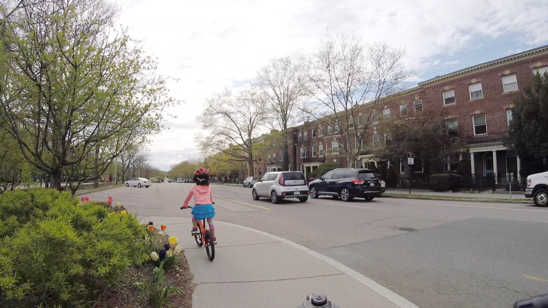
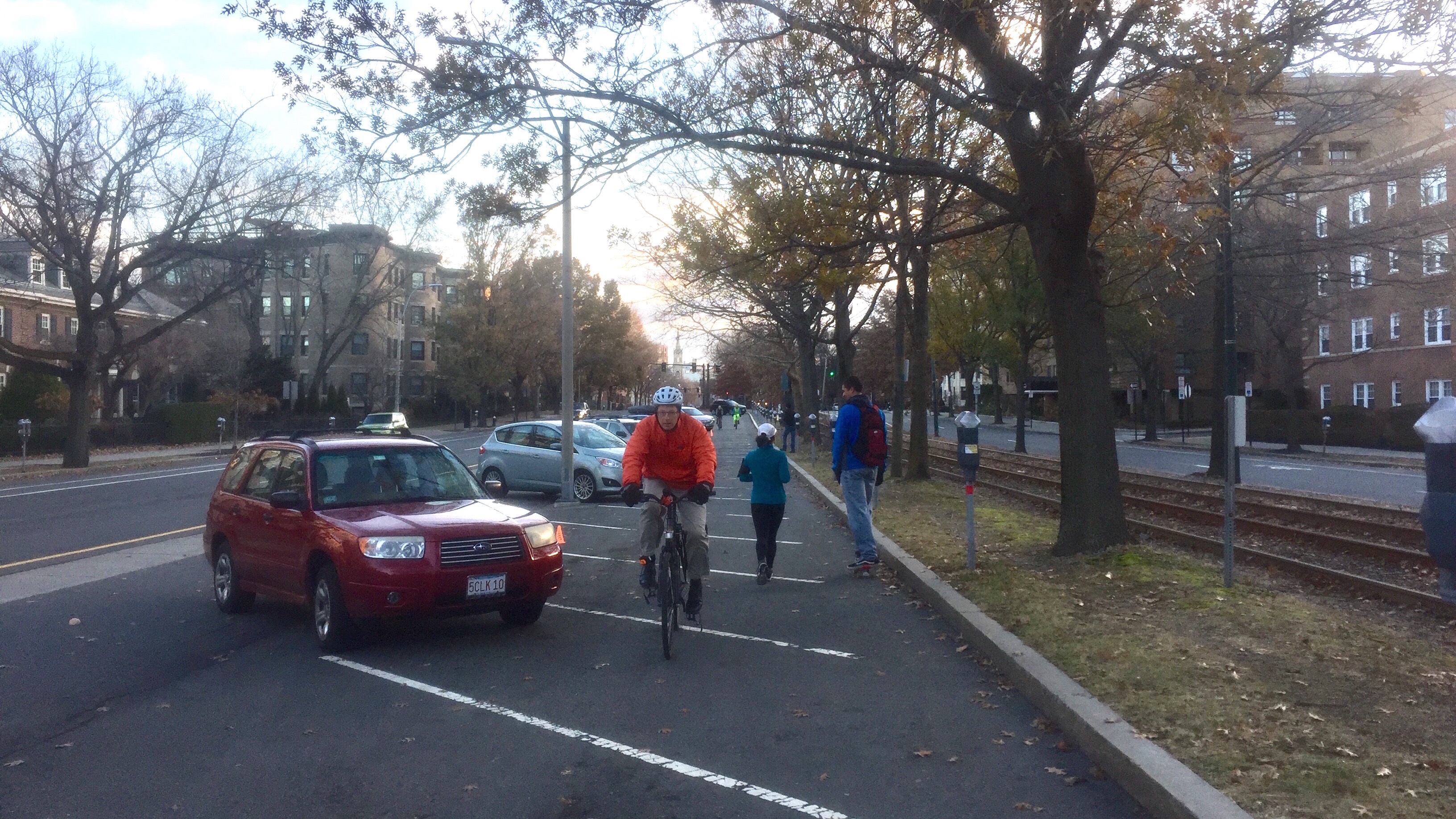
  + Covid preview (Mar. 28 - 30 [- June 4], 2020):

        Another collection of videos of the median of Beacon St.
        in or near to the historical bridle path, these during a
        period of social distancing to mitigate spread of Covid-19:

        (+) around Coolidge Cnr., St. Mary's, and Washington Sq.
            (4:35 - 5:45 PM, Sat., Mar. 28, 2020);

        (+) traveling west Washington Sq. - Cleveland Cir.
            (around 4:35 PM, Wed., May  6, 2020; 2x actual speed); and

        (+) traveling east Washington Sq. - Coolidge Cnr.
            (around 3:55 PM, Thu., May 28, 2020; 2x actual speed).


  + Preview (Oct. 4 - 14, 2017 and July 21 - Aug. 2, 2018):

        A collection of videos of bicycling along the median of
        Beacon St. as near to the historical bridle path route as
        currently possible, traveling east:

        (+) (near) Englewood Ave. - Winthrop Rd.
            (around 9 AM, Sat., July 21, 2018; omni view [#N2]);

        (+) Washington St. - Pleasant St.
            (around 12:30 PM, Wed., Oct. 4, 2017; forward view); and

        (+) Kent/Powell St. - (near) St. Mary's St.
            (around 9 AM, Sat., July 21, 2018; omni view [#N2]).


  + Historical view (June 8 - 11, 2018):

        A collection of historical photos of the median of Beacon St.
        during the period---circa 1890-s - 1900-s---shortly after
        the Olmsteds' design for the street was first realized,
        when the original bridle path was intact.


Consider:

  + Demonstration outline (Dec. 6, 2018 - Jan. 2, 2019):

        Outlines potential methods, materials, sites, and times for
        events and temporary installations to demonstrate reopening
        a route for moderate-speed person-scale travel along Beacon St.
        within the historical bridle path space in the median.


  + Concept bottom line (Dec. 9, 2017 - May 7 [- June 22], 2018):

        Results of preliminary CAD modeling and ground-truthing study
        of the feasibility of (re)creating this median non-car path---
        for protected bicycling (primarily, at least initially), and
        to shorten cross-walk distances and moderate car travel speeds
        ---along the whole of Beacon St. in Brookline.

        Illustrates and examines this potential improvement by:

        (+) updating Mass. DOT's traffic plans for the street's
            last major renovation (largely its current built form),

        (+) via a "shrink to fit" cross-section transformation
            (modestly narrowing and shifting the car facilities on
            the wide side of the train tracks).

        Especially addresses the degree of geometric fit and specific
        challenges to implementation presented by existing conditions.


  + Concept introduction (Sep. 13 - 26, 2017):

        Frames the concept of a modern incarnation of the bridle path,
        precedents, and a course of study to further develop design
        and implementation specifics, in order to support evaluation
        and discussion by Beacon St.'s broad array of stakeholders.

  + Concept map with annotations (Aug. 15 - 24, 2017):

        Models a break-down of Beacon St. into segments divided per
        the usability of its current condition for two-way bicycling
        (and possibly walking) along the median.  And overlays
        measured illustrations of the street's potential condition
        [#N1] if it were transformed to create a dedicated path there
        for these uses.

  + Cross-section analysis (July 18 - Aug. 13, 2017):

        Examines the default cross-section of Beacon St., which exists
        at most locations---largely everywhere except intersections.
        Includes values for the street's current built form and also
        for potential forms [#N1] that would create a dedicated median
        bicycling (and possibly walking) path.


Sincerely,

Jules Milner-Brage


-  -  -  -  -  -  -  -  -  -  -  -  -  -  -  -  -  -  -  -  -  -  -  -  -


[#N2---]

Where 'omni view' means: these are spherical recordings---

In a suitably modern web browser or mobile-device viewer app.,
you can pan/tilt the virtual camera to change which direction
you're looking.  A rearward perspective is often illuminating.

If the image seems grainy, try changing your player's "Quality"
setting to select one of the "1080s", or better, resolution
variants of the video.  The original recordings were made at
"2160s" (i.e., "4K [HD]") resolution.


[#N1---]

These early documents focused on one strategy for freeing space
in the median (back-in angled car parking without a dedicated
maneuvering lane) and one alignment of a path in the resultant
space (along the already-paved route, which is curvy at curb
bulb-outs but amenable to definition via flex-posts, largely
without requiring new pavement or repositioning of curbs).

With further study, additional strategies (e.g., narrowing
car travel, turn-queueing, and parking maneuvering lanes) and
additional alignments (e.g., more-straight routes, which exist
at some curb bulb-out locations but which would likely require
some new pavement and/or repositioning of curbs) are explored.