Demonstration outline: Reopening the bridle path on Beacon St.
in Brookline in temporary, limited installations---


Prepared by:
    Jules Milner-Brage
Revision as of:
    Dec. 6, 2018 - Jan. 2, 2019
    (precursor: July 20 - Aug. 3, 2018)


-  -  -  -  -  -  -  -  -  -  -  -  -  -  -  -  -  -  -  -  -  -  -  -  -
What/why?

    To explore protected two-way moderate-speed person-scale travel---
    via bike, scooter, wheelchair, jogging, etc.---along Beacon St.
    within the historical space of the Olmsted-designed bridle path
    in the median.

    To strengthen the sense of place and community along Beacon St.,
    and in the parks and business districts it connects, and to
    complement other community-building events (e.g., the Bike Parade,
    the Coolidge Corner Arts Festival, Porchfest, Foodtruck Friday,
    the Village Fair, First Light).

    To engage Beacon St.'s many stakeholders regarding questions of
    whether the street's median should be further used in this way
    and, if so, via what design/s---through experience in the field,
    so as to inform discussions at Town Hall.

    In support of a resolution [#R1] adopted by Town Meeting.
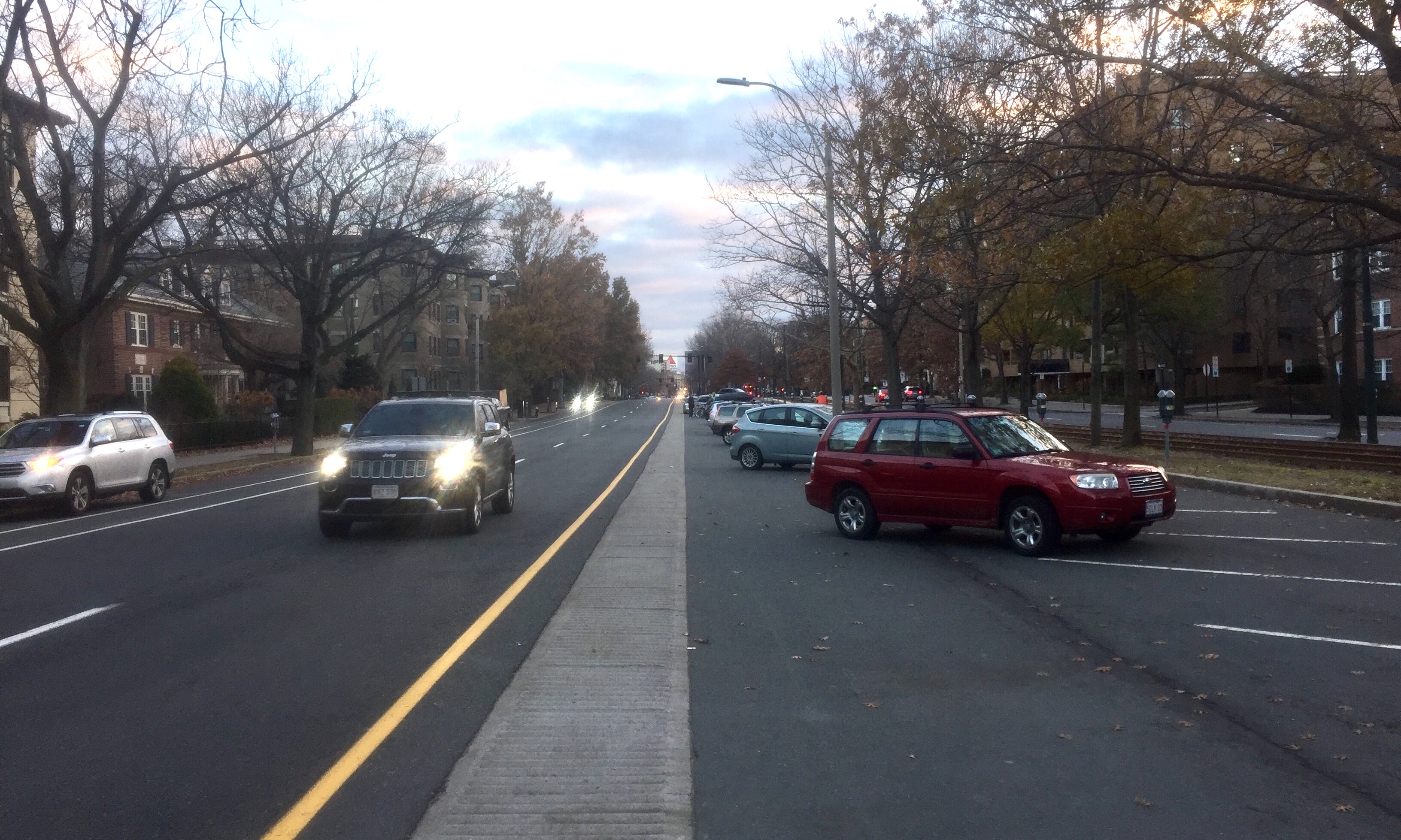
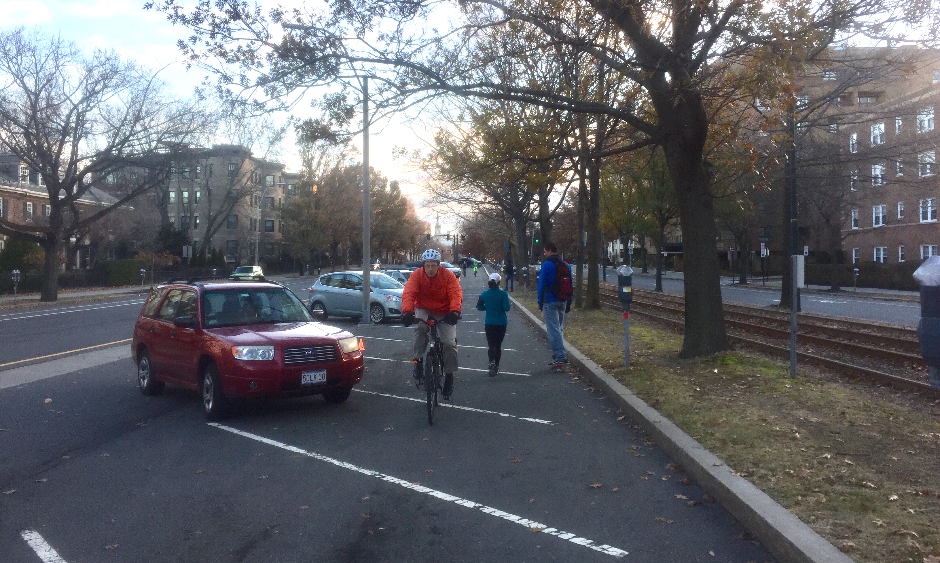
Mock-up of a 10-ft.-wide median path:
Kent/Powell St. - Hawes St.
(around 7:20 AM, Sat., Dec. 1, 2018)
When?

    Sat. OR/and Sun.:

        if temporarily prohibiting median car parking---

    (~) if on Sun.: no "lost" car parking revenue;
        BUT MAY conflict with more actual median car parking

    (-) BUT if over multi-day: conflicts with permitted/agreed-to
        overnight (11 PM - 8 AM) median car parking


Where?

    per concept map [#R2]---

    sub-span/s between business districts---

(E) Coolidge Cnr. - St. Mary's St. / Audubon Cir.:

    (=) St. Paul St. (OR [>] Charles St. OR [<] Kent/Powell St.) -
        Carlton St.

    (+) connect Amory Playground: via quiet alley between Amory St. and
        Hawes St. (BUT with indirect crossing) OR via quiet-ISH Amory St.
        (BUT with indirect crossing) OR via quiet-ISH Powell St.
    (+) in circa 2020: connect Riverway Park (of Emerald Necklace):
        via quiet-ISH Carlton St. + Footbridge (restoration to begin
        in 2019, hopefully)

    (-) BUT median walk signals + curb ramps absent over St. Paul St.
        and over Kent/Powell St.

    (-) BUT a lot of all-hours Sun. + overnight every-day USPS truck
        parking agreed-to in median between Charles St. - Kent/Powell St.
        (esp. St. Paul St. - Kent/Powell St.)
    (~) BUT a little overnight car parking permitted in median near
        Hawes St.

(W) Cleveland Cir. - Washington Sq.:

    (=) Strathmore Rd. - Tappan St. / Williston Rd. (OR [>] Winthrop Rd.)

    (+) connect Waldstein Playground: via quiet Strathmore Rd. OR
        via quiet Englewood Ave. / Clinton Path
    (+) connect Driscoll School Playground: via quiet Williston Rd. +
        Salisbury Rd.
    (+) in long term: connect Chestnut Hill Reservoir: via a continued
        median bike/etc. path (through City of Boston)

    (-) BUT median walk signals + curb ramps absent over Corey/Dean Rd.

    (~) BUT some daytime Sun. church-goer car parking MAY happen in
        median near Dean Rd. and near Englewood Ave. / Clinton Path
    (~) BUT a little overnight car parking permitted in median near
        Williston Rd.
(C) Washington Sq. - Coolidge Cnr.:

    (=) Summit Path - Marion St. (OR [>] Winchester St.)

    (+) connect Griggs Park: via quiet-ISH Marion St. + Marion Path OR
        via quiet Intervale Crosscut (BUT with indirect crossing) +
        Griggs Rd.
    (+) connect Driscoll School Playground: via quiet-ISH Westbourne Ter.
        (BUT with stairs and one-way)

    (~) BUT a lot of overnight car parking permitted in median between
        Fairbanks St. - Marion St.


How?

    per concept section and plan [#R3], approx.---

    via inexpensive, temporary materials [#R4]
    (e.g., traffic cones, traffic tape, tempera paint)---

    BUT with some challenges presented by existing conditions---

(1) Reallocating space to the median---primarily that of the existing
    bike lane, in the door zone of the outer-edge car parking stalls
    on the wide side of the street---if we are to provide the full
    space there for car parking and for people outside of vehicles,
    per the bridle path (median bike/etc. path) restoration concept.

    This wide-side space reallocation would involve shifts outward
    of the median solid-yellow edge line and the broken-/solid-white
    lines between the car travel/left-turn lanes (and perhaps a modest
    shift outward of the outer solid-white edge line).

    It seems we could reduce the scope of temporary line revision,
    in the interest of reducing the quantity of time required for
    installation and of material used, through either:

    (A) a shorter project area with fully revised wide-side lines,
        for the whole length of each included block; or

    (B) a longer project area with wide-side lines left in existing
        positions, either fully or perhaps largely, and compromised
        median space: for car parking between intersections and
        perhaps for people outside of vehicles at intersections
        (and mid-block curb peninsulas).

(2) Compromised space in the median between intersections for
    car parking---that for stalls plus maneuvering space, which
    should be largely maintained in width (and shifted outward)---
    if we do not revise the wide-side lines in conjunction with
    adding a bike/etc. path along the median inset the car stalls.

    It seems we could compensate for this by either:

    (A) reducing the cross-section dimension of the maneuvering space:
        by provisionally rotating the stalls 90 degrees to a back-in
        angled orientation (which may not require as much maneuvering
        space as head-in, due to its not requiring one to "blindly"
        back out of the stalls toward the left-hand travel lane); or
    (B) reducing the cross-section dimension of the stalls:
        by provisionally rotating them 45 degrees to a parallel
        orientation (which, however, would reduce per-block stall
        supply by approx.: 40% in the median, but only 18% overall); or

    (C) showing a revised cross-section in a less-participatory way:
        by temporarily prohibiting the public from parking in the
        median and statically positioning a number of our cars
        there outset by the width of a bike/etc. path.

(3) Compromised space in the median at intersections (and mid-block
    curb peninsulas) for people outside of vehicles---primarily
    that for waiting to walk across the car lanes, which should be
    shifted outward (and maintained in width)---if we do not revise
    the wide-side lines in conjunction with adding cycling/etc.
    traffic along the median.

    It seems we could compensate for this by either:

    (A) temporarily bending the lines for the car travel/left-turn
        lanes outward, into the existing outer-edge bike lane, (only)
        in the areas immediately preceding/at/following intersections
        (and mid-block curb peninsulas); or

    (B) temporarily directing car left turns to be made from the
        left-hand travel lane and repurposing the left-turn lane
        (which, however, would yield free space only at some
        intersections and only preceding each such intersection).

(4) Narrower sidewalks along the median at some intersections
    (and walkways along the median at mid-block curb peninsulas).

    This compromises space for people outside of vehicles---
    primarily that for walking along the median from/to car parking
    between intersections plus for cycling/etc. along the median,
    which should be widened---if we do not add pavement to the
    wide side of the median in conjunction with adding cycling/etc.
    traffic along the median.

    If we do not compensate for this via less-temporary materials
    (e.g., stone dust, asphalt), it seems we would temporarily have
    to accept this compromised space in the median at each such
    intersection and so need to direct people to be esp. cautious
    (reminding those cycling/etc. to yield to those walking).

(5) Absent walk signals and curb ramps (and crosswalk markings)
    between the sidewalks along the median at a few intersections.

    If we are not allowed to direct the public to follow the train
    signals (which are present at every signalized intersection), and
    if we cannot provisionally add bike/walk signals (following the
    same phasing as the train signals), it seems we could compensate
    for the absent walk signals by temporarily employing people to
    serve as crossing chaperones (directing others by following the
    train signals themselves).

    It seems we could compensate for the absent curb ramps by
    temporarily adding wooden ramps like those used for sidewalk
    construction detours (and adding cross-bike/-walk markings).
-  -  -  -  -  -  -  -  -  -  -  -  -  -  -  -  -  -  -  -  -  -  -  -  -


[#R1:]

    Resolution calling for a study of the feasibility of restoring
    the Olmsted bridle path along the median of Beacon St.
    in Brookline:

        <http://milner-brage.com/jules/2018/08/29/
                resolution-bridle-path-beacon-st-brookline>

[#R2:]

    Concept map: Restoring the bridle path on Beacon St. in Brookline:

        <http://google.com/maps/d/
                viewer?mid=1QK1bT1ZdiW93wtKxiDMvqKKyQfY>

[#R3:]

    Concept bottom line: Restoring the bridle path on Beacon St.,
    per preliminary CAD modeling and ground-truthing study of
    its whole extent in Brookline:

        <http://milner-brage.com/jules/2018/05/07/
                concept-bottom-line-bridle-path-beacon-st-brookline>

[#R4:]

    Tactical Urbanist's Guide To Materials and Design
    (by The Street Plans Collaborative):

        <http://tacticalurbanismguide.com/guides/
                tactical-urbanists-guide-to-materials-and-design>